Ghana, a captivating country in West Africa, is celebrated for its vibrant culture, historical landmarks, and stunning natural attractions. Whether you’re exploring the bustling streets of Accra, delving into Kumasi’s rich history, or venturing into the serene countryside, having accurate and reliable maps is essential for a smooth and enriching travel experience.
Why Do You Need Maps of Ghana, Accra, and Kumasi?
Maps are more than just navigation tools; they’re the key to unlocking Ghana’s treasures. With the right maps, you can:
- Navigate Effortlessly: Avoid getting lost, even in the busiest cities or remote areas.
- Plan Efficiently: Find the fastest and safest routes to your destinations.
- Discover Hidden Gems: Locate off-the-beaten-path markets, cultural landmarks, and natural wonders.
- Understand Local Geography: Get a sense of Ghana’s regions, cities, and rural terrains.
Whether you’re a first-time visitor or a frequent traveler, maps of Ghana, Accra, and Kumasi provide the guidance needed to explore confidently.
EVERYTHING HANDLED FOR YOU
Akwaaba Covers the Full Trip — Not Just the Tour
Overview of Maps in Ghana
- Regional Maps of Ghana
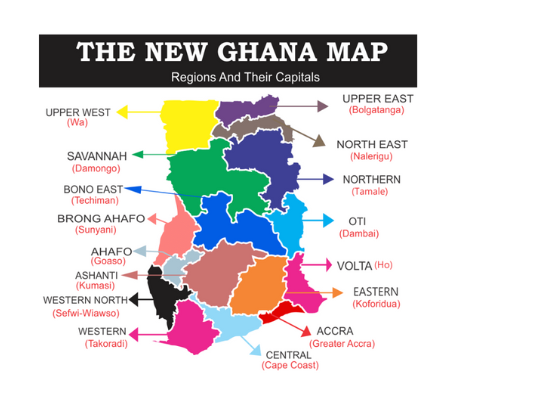
Ghana comprises 16 regions, each with its unique attractions:
- Ashanti Region: Famous for Lake Bosomtwe, Manhyia Palace, and Kejetia Market.
- Volta Region: Renowned for Wli Waterfalls, Mount Afadjato, and serene landscapes.
- Northern Region: Home to Mole National Park, traditional mud mosques, and vibrant wildlife.
Regional maps help travelers explore these areas and understand the geography of the country.
- City Maps of Accra and Kumasi
Accra, the nation’s bustling capital, and Kumasi, the cultural heartland, are two of Ghana’s most iconic cities. Maps of these cities offer detailed layouts of neighborhoods, attractions, transport routes, and amenities.
Detailed Maps of Accra
Accra is a dynamic metropolis with a blend of modernity and tradition. A map of Accra can guide you to:
Key Neighbourhoods
- Osu: Known for Oxford Street’s lively shops and restaurants.
- Labone: A quieter area with boutique hotels and cafes.
- Jamestown: A historic district featuring the Jamestown Lighthouse and colonial-era architecture.
Top Attractions
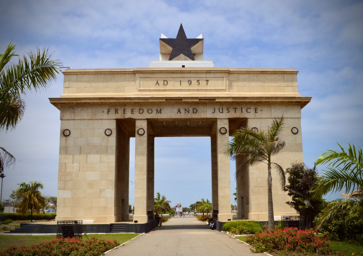
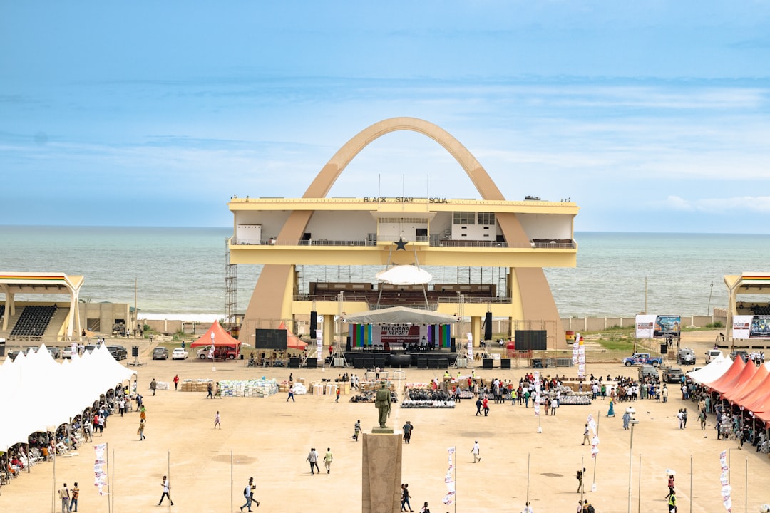
- Independence Square: A symbol of Ghana’s freedom.
- Kwame Nkrumah Mausoleum: Honouring Ghana’s first president.
- Labadi Beach: Perfect for relaxation and entertainment.
Transport in Accra
Accra’s traffic can be challenging, but maps help you navigate tro-tro routes, locate bus terminals like the VIP Bus Station, and plan efficient routes.
Detailed Maps of Kumasi
Known as the “Garden City,” Kumasi is the cultural capital of Ghana and the heart of the Ashanti Region.
Key Neighbourhoods
- Adum: The central business district.
- Bantama: A hotspot for nightlife and local cuisine.
- Asokwa: A blend of residential and commercial areas.
Top Attractions
- Manhyia Palace Museum: The seat of the Ashanti kings.
- Kejetia Market: The largest open-air market in West Africa.
- Kumasi Zoo: Great for family-friendly activities.
Transport in Kumasi
Maps are crucial for navigating Kumasi’s busy roads and markets, especially Kejetia Market’s sprawling layout. Locate key bus terminals like Asafo VIP Station or plan trips to surrounding areas.
Best Resources for Ghana Maps
Digital Maps
- Google Maps: Offers real-time traffic updates and detailed routes in Accra and Kumasi.
- Maps.me: Ideal for offline navigation in rural areas.
- OpenStreetMap: Community-driven maps with local insights.
- Ghana Map App: A specialized app designed for travelers in Ghana.
Physical Maps
- Available at bookstores such as EPP Books in Accra.
- Provided at airports, hotels, and tourist information centers.
Travel Tips for Using Maps in Ghana
- Download Offline Maps: Internet access may be limited in remote areas.
- Ask Locals for Help: Ghanaians are known for their hospitality and will gladly assist.
- Plan Ahead: Mark key destinations before starting your journey.
- Avoid Traffic: Use maps to navigate around busy hours in cities like Accra.
Explore Ghana with Confidence
From navigating Accra’s vibrant streets to discovering Kumasi’s cultural treasures or venturing into the scenic landscapes of Ghana’s regions, maps are your ultimate travel companion. Whether you prefer digital tools like Google Maps or physical maps from local stores, they’ll help you explore safely, efficiently, and with confidence.
Ready to begin your adventure? Grab a map, plan your route, and start uncovering the wonders of Ghana today!
Plan Your Ghana Trip
- Ghana Vacation Packages
- Detty December 2026 Packages
- Heritage Trail Tour
- Food Tasting Tour
- Things to Do in Ghana
- Best Time to Visit Ghana
- First-Time Visitors Guide

Akosua Adoma is Akwaaba’s Marketing Manager and Ghana travel specialist. She has spent years exploring Ghana’s most iconic destinations — from the Cape Coast dungeons to the canopy walkways of Kakum — and helping diaspora travelers reconnect with the continent. She oversees Akwaaba’s content strategy, community partnerships, and brand storytelling.
Turn this itinerary into a booked trip
You’ve got the plan — let Akwaaba handle the rest: flights guidance, visa support, verified local guides, airport pickup and insurance, in one booking.
Lock in your Ghana trip for just $100 down
Flights, vetted stays, local guides and SanlamAllianz insurance — all handled. Reserve your spot with $100, pay the balance later.
REAL TRIPS · REAL PEOPLE
See What Ghana Actually Looks Like
From our travelers’ feeds — unfiltered Ghana experiences

Plan your homecoming
Ready to experience Ghana for real?
Akwaaba handles the whole trip — curated packages, day experiences, and the hottest events. Just $100 reserves your spot, and you can split the balance into easy payments.
Use code AKWAABA for 5% off your first booking · Rated 4.7★ by 140+ travelers